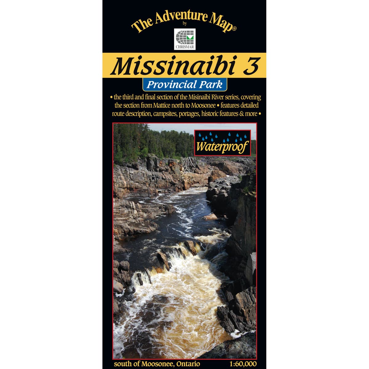
The third and final segment of the Missinaibi takes you from Mattice, all the way to Moosonee and beyond to James Bay. This map covers a total of 314 water kilometres with historic sites, white water rapids and portages and beautiful scenery where the terrain shifts from the Precambrian Shield into the Hudson Bay Lowlands. The Hudsons Bay Lowlands are expansive wetlands that span 320,000 km² and offer beautiful scenery and new, northernly species of wildlife such as polar bears, arctic fox, arctic hare, caribou and various species of sea ducks.
The Adventure Map Missinaibi 3 - Mattice to Moosonee
- Scale: 1:60,000
- Waterproof
- Map features: the route from the Town of Mattice all the way downstream or northward to Moosonee near James Bay,
- Back Side: Providing local history, route descriptions, safety issues, contact and other information to help you plan and take your trip
Designed for Adventurers
The Adventure Map is specifically designed for outdoor adventurers such as hikers, backpackers, and paddling enthusiasts who need an accurate, up-to-date, rugged map to get them into and safely back from the wilderness. You'll find all kinds of innovations and enhancements not found on other maps. Chrismar has even eliminated those annoying declination problems for you.
Compact and Waterproof
The Adventure Map is compact (most measure 18x24"/45x61cm or less), easy to read, and doesn't require instructions to help you with folding! The Adventure Maps are also waterproof. The maps are printed on specially-made, extra tough, waterproof plastic. Put to the test, of being stomped, crumpled and drowned, to be certain it won't let you down in adventurous (i.e. fog, rain, sleet, snow, sweat) situations.
Loaded with Info
The Adventure Map isn't just an exceptionally good topographic recreation map; The back is also filled with colour photos, important information about the area including natural and human history, local regulations, outdoor tips, safety concerns, addresses, useful phone numbers and more.