Up-to-date back-country maps for Canoeing in Ontario provide detailed route options so you know all your hiking, canoeing and site seeing options.
Our Mississauga retail store will be closed Friday, July 24, for staff field training. Online ordering remains available. Regular store hours resume Saturday, July 25.
X
Ontario Canoe Map Guides
Products 1 - 33 of 33
Filter Results
Done
Products 1 to 33 of 33
coec choice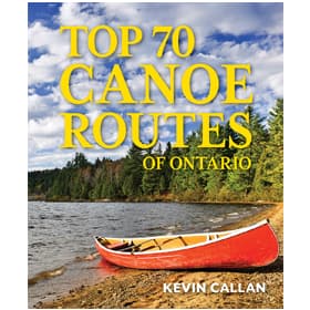 Top 70 Canoe Routes of Ontario
$35.00coec choice
Top 70 Canoe Routes of Ontario
$35.00coec choice Temagami Planning Map - 3rd Edition
$39.00
Temagami Planning Map - 3rd Edition
$39.00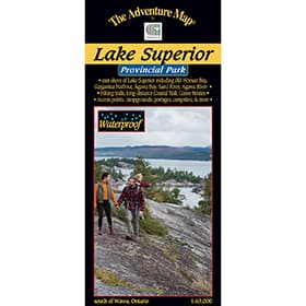 The Adventure Map Lake Superior Provincial Park
$16.95
The Adventure Map Lake Superior Provincial Park
$16.95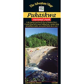 The Adventure Map Pukaskwa National Park
$16.95
The Adventure Map Pukaskwa National Park
$16.95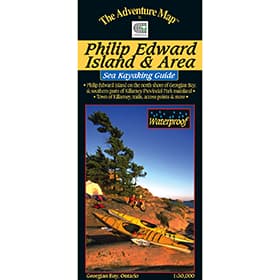 The Adventure Map Philip Edward Island
$13.95
The Adventure Map Philip Edward Island
$13.95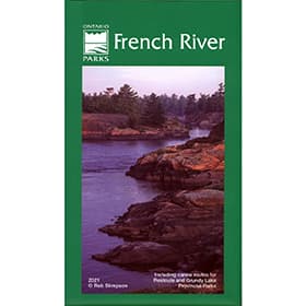 French River Planning Map
$18.95
French River Planning Map
$18.95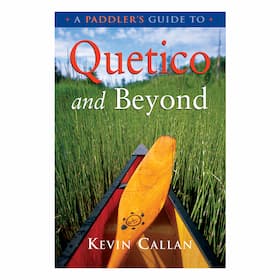 A Paddler's Guide to Quetico and Beyond
$24.95
A Paddler's Guide to Quetico and Beyond
$24.95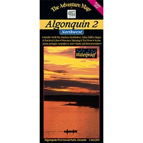 The Adventure Map Algonquin 2 Northwest
$16.95
The Adventure Map Algonquin 2 Northwest
$16.95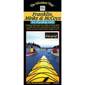 The Adventure Map Franklin, Mink & McCoy Islands
$13.95
The Adventure Map Franklin, Mink & McCoy Islands
$13.95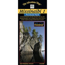 The Adventure Map Missinaibi 1 - Lakes Area
$16.95
The Adventure Map Missinaibi 1 - Lakes Area
$16.95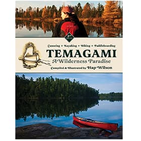 Temagami - A Wilderness Paradise
$24.95
Temagami - A Wilderness Paradise
$24.95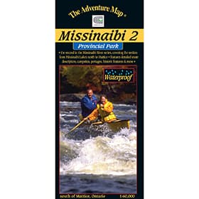 The Adventure Map Missinaibi 2 - Missinaibi Lake to Mattice
$16.95
The Adventure Map Missinaibi 2 - Missinaibi Lake to Mattice
$16.95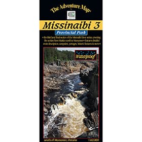 The Adventure Map Missinaibi 3 - Mattice to Moosonee
$16.95
The Adventure Map Missinaibi 3 - Mattice to Moosonee
$16.95 The Adventure Map Algonquin 1 Corridor North
$16.95
The Adventure Map Algonquin 1 Corridor North
$16.95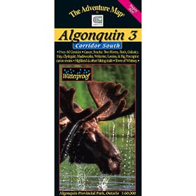 The Adventure Map Algonquin 3 Corridor South
$16.95
The Adventure Map Algonquin 3 Corridor South
$16.95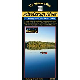 The Adventure Map Mississagi River
$16.95
The Adventure Map Mississagi River
$16.95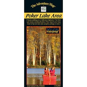 The Adventure Map Poker Lake
$6.95
The Adventure Map Poker Lake
$6.95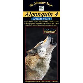 The Adventure Map Algonquin 4 Central North
$16.95
The Adventure Map Algonquin 4 Central North
$16.95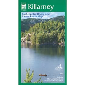 Killarney Planning Map
$24.95
Killarney Planning Map
$24.95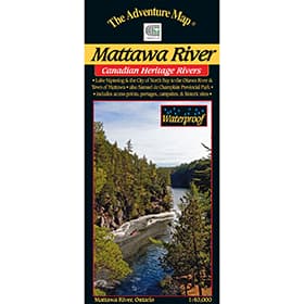 The Adventure Map Mattawa River
$13.95
The Adventure Map Mattawa River
$13.95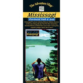 The Adventure Map Mississagi Provincial Park and Area
$14.95
The Adventure Map Mississagi Provincial Park and Area
$14.95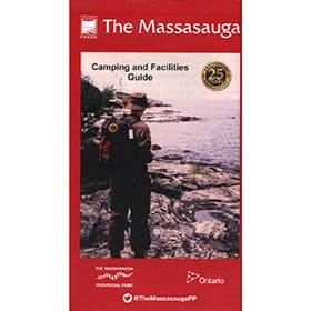 The Massasauga Planning
$16.95
The Massasauga Planning
$16.95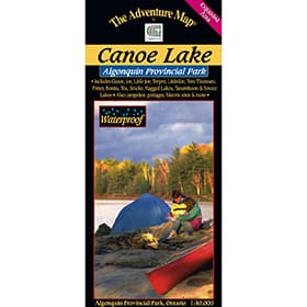 The Adventure Map Algonquin Canoe Lake
$9.95
The Adventure Map Algonquin Canoe Lake
$9.95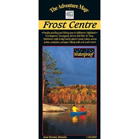 The Adventure Map Frost Centre
$13.95
The Adventure Map Frost Centre
$13.95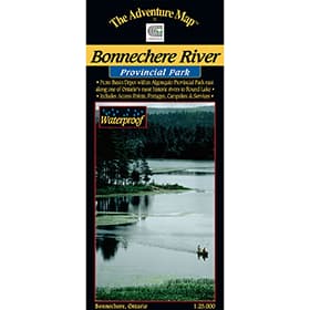 The Adventure Map Bonnechere River
$8.95
The Adventure Map Bonnechere River
$8.95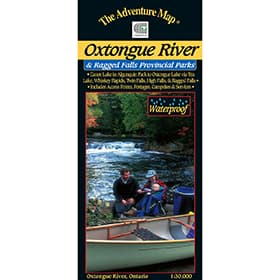 The Adventure Map Oxtongue River Provincial Park
$8.95
The Adventure Map Oxtongue River Provincial Park
$8.95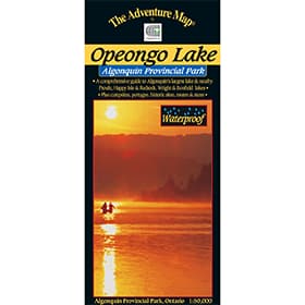 The Adventure Map Algonquin PP8 - Opeongo
$9.95
The Adventure Map Algonquin PP8 - Opeongo
$9.95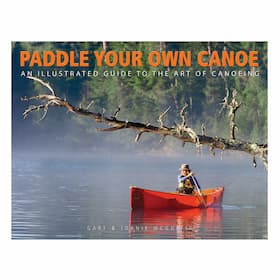 Paddle Your Own Canoe
$29.95
Paddle Your Own Canoe
$29.95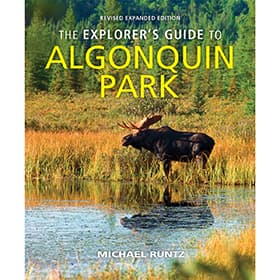 The Explorer's Guide to Algonquin Park
$29.95
The Explorer's Guide to Algonquin Park
$29.95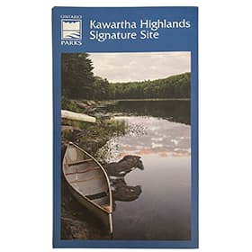 Kawartha Highlands Signature Site Map
$12.95Sold Out
Kawartha Highlands Signature Site Map
$12.95Sold Out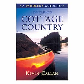 A Paddler's Guide to Ontario's Cottage Country
Sold Out
A Paddler's Guide to Ontario's Cottage Country
Sold Out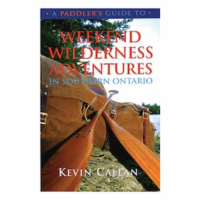 A Paddler's Guide To Weekend Wilderness Adventures in Southern Ontario
Sold Out
A Paddler's Guide To Weekend Wilderness Adventures in Southern Ontario
Sold Out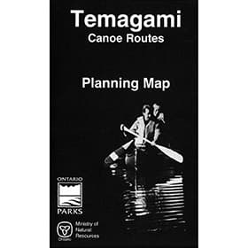 Temagami Planning Map
Top 70 Canoe Routes of Ontario
$35.00coec choiceTemagami Planning Map - 3rd Edition
$39.00The Adventure Map Lake Superior Provincial Park
$16.95The Adventure Map Pukaskwa National Park
$16.95The Adventure Map Philip Edward Island
$13.95French River Planning Map
$18.95A Paddler's Guide to Quetico and Beyond
$24.95The Adventure Map Algonquin 2 Northwest
$16.95The Adventure Map Franklin, Mink & McCoy Islands
$13.95The Adventure Map Missinaibi 1 - Lakes Area
$16.95Temagami - A Wilderness Paradise
$24.95The Adventure Map Missinaibi 2 - Missinaibi Lake to Mattice
$16.95The Adventure Map Missinaibi 3 - Mattice to Moosonee
$16.95The Adventure Map Algonquin 1 Corridor North
$16.95The Adventure Map Algonquin 3 Corridor South
$16.95The Adventure Map Mississagi River
$16.95The Adventure Map Poker Lake
$6.95The Adventure Map Algonquin 4 Central North
$16.95Killarney Planning Map
$24.95The Adventure Map Mattawa River
$13.95The Adventure Map Mississagi Provincial Park and Area
$14.95The Massasauga Planning
$16.95The Adventure Map Algonquin Canoe Lake
$9.95The Adventure Map Frost Centre
$13.95The Adventure Map Bonnechere River
$8.95The Adventure Map Oxtongue River Provincial Park
$8.95The Adventure Map Algonquin PP8 - Opeongo
$9.95Paddle Your Own Canoe
$29.95The Explorer's Guide to Algonquin Park
$29.95Kawartha Highlands Signature Site Map
$12.95Sold OutA Paddler's Guide to Ontario's Cottage Country
Sold OutA Paddler's Guide To Weekend Wilderness Adventures in Southern Ontario
Sold OutTemagami Planning Map
About Ontario Canoe Maps
Canada is a country that was forged by use of the canoe. It’s an indelible symbol and one that resonates with the core of our Canadian identity. Canoe guides offer the chance to re-connect with this history and explore areas that are inaccessible by other means. Whether learning about the canoe and it’s history with the First Nations, retracing an old voyageur route, or simply planning a vacation with the family, a canoe guide is invaluable in gaining knowledge and understanding of canoeing routes and techniques.
Our Ontario Canoe Maps
We stock only the best in Ontario Canoe Maps so you can rest assured knowing you're COEC Equipped.
Top 70 Canoe Routes of OntarioNewly updated for 2023, Top 70 Canoe Routes of Ontario adds 10 more routes and over 50 more pages, making it THE classic guide to the very best canoeing the province of Ontario has to offer.
Temagami Planning Map - 3rd EditionFor the past two decades, the Friends of Temagami has been documenting, restoring and promoting lost, forgotten and underused canoe routes in Temagami. This map is the result of a comprehensive review of existing information coupled with on-the-ground explorations.
The Adventure Map Lake Superior Provincial Park This comprehensive 1:63,000 map to the Park is all you'll need to tackle a truly extraordinary paddling, hiking or backpacking challenge. This huge Park includes many backcountry opportunities in addition to the coast, as in 143km of hiking & backpacking trails, including a challenging 65km Coastal backpacking trail, over 200km of backcountry canoe routes, a superb 95km Coast paddling route, 205 car campsites in 2 well-serviced campgrounds, over 160 backcountry campsites, not to mention the 3,158 lakes.
The Adventure Map Pukaskwa National ParkOn the eastern coast of Lake Superior, Pukaskwa's dramatic and rugged terrain offers 135km of shoreline to paddle and over 60km of hiking through beautiful boreal forest. At a scale of 1:30,000 check out mapped features like paddling campsites, historic sites, or the White River Suspension Bridge with its awesome view high above a roaring waterfall.
The Adventure Map® Philip Edward IslandGeorgian Bay is home to some of the most beautiful landscapes, including Phillip Edward Island. Neighbouring with Killarney Provincial Park, and noted as one of the best areas for wild kayaking and camping in North America, this map showcases Collins Inlet, Beaverstone Bay, and the south edge of Killarney.
French River Planning Map This waterproof edition of the French River Provincial Park can be used both at home as a general reference map for preplanning, and on the water to view the entirety of the park.
A Paddler's Guide to Quetico and BeyondKevin Callan's "A Paddler's Guide to Quetico and Beyond" is a guide to Northwestern Ontario's "Canoe Country" - Ontario's Quetico Provincial Park (the 2nd largest park in the province which adjoins Minnesota's Boundary Waters Canoe Area), and includes detailed route descriptions, maps showing all access points, important river features and accurate portage lengths.
The Adventure Map Algonquin 2 Northwest A detailed topographic map and guide to the more remote northwest quadrant of Algonquin Provincial Park. This map covers the area from Kawawaymog Lake, outside the west park boundary all the way past Brent access point on Cedar Lake, it overlaps the north edge of the Algonquin Provincial Park 1 map, and the west edge of the Algonquin Provincial Park 4 map.
The Adventure Map Franklin, Mink & McCoy IslandsA 1:30,000 scale waterproof map that includes Franklin Island and its satellite islands, the Mink Islands, and the McCoy Islands. This area of Georgian Bay is an essential destination for any sea kayaking enthusiast, the pristine wilderness of these islands makes for a beautiful and scenic trip.
The Adventure Map® Missinaibi 1 - Lakes AreaThe Missinaibi River is the longest unbroken stretch of river for paddling in Ontario. This map features Missinaibi Lake, and Little Missinaibi Lake, which both offer beautiful cliffs, old growth trees and pictograph sites. This map also covers paddling areas outside the park, such as Shumka/Missinabie Route in Chapleau Crown Game Preserve. View backcountry campsites, portages, access points and points of historical interest, all at a waterproof scale of 1:50,000.
Temagami - A Wilderness ParadiseCompiled by Hap Wilson, Temagami: A Wilderness Paradise (3rd Edition) features the best canoe, kayak and hiking routes in the wild Temagami region of Ontario.
The Adventure Map Missinaibi 2 - Missinaibi Lake to MatticeThis second guide in the Missinabi series covers 191 kms of water: from the north end of Missinaibi Lake to the Town of Mattice. Access to this area can be difficult, so to help in your preplanning stage, Chrismar added information about travel options to reach this destination, including car, shuttles, trains, and outfitters.
The Adventure Map Missinaibi 3 - Mattice to MoosoneeThe third and final segment of the Missinaibi takes you from Mattice, all the way to Moosonee and beyond that to the southern most point of the Arctic ocean and James Bay. This map coveres a total of 314 kms of water with historic sites, white water rapids and portages.
The Adventure Map Algonquin 1 Corridor NorthA detailed topographic map and guide to Algonquin Provincial Park. Includes paddling routes, hiking and backpacking trails, and all attractions along highway 60 corridor. This map covers the area from Opeongo Lake, the visitor centre, park boundary in the west, Tim River, Lake La Muir Ragged Lake and Whitefish Lake.
The Adventure Map Algonquin 3 Corridor South A detailed topographic map and guide to Algonquin Provincial Park along, and well south, of the highway 60 corridor. This map covers the area from the Town of Whitney in the east, the Kawagama Lake outside the Park boundary in the west, and from Canoe and Opeongo lakes in the north, to Hay and Madawaska lakes in the south. It also shows Dividing Lake P.P. Which is the home of towering old growth white pines
The Adventure Map Mississagi RiverThis is one of Ontario's lesser known and lesser used wilderness paddling rivers. This waterproof, 1:80,000 scale map, features the area from the hamlet of Biscotasing on the Biscotti Lake via Ramsey, Spanish Chutes, Barney, Bark and Rocky islands to Aubrey falls, including campsites, portages detailed paddling guide.
The Adventure Map Poker LakeA detailed 1:15,000 map of the Poker Lake area: crown land that is great for canoeing day trips, or up to 4 day journeys with short portages.
The Adventure Map Algonquin 4 Central North The fourth map from Chrismar in the Algonquin Provincial Park series. This map covers the area from beyond the park boundary in the North, all the way to the South in Dickson Lake. Also includes the Petewawa River, all the way up to McManus Lake at the east boundary. There are 6 access points on this map including several of the most remote in the park, which leads to routes where you're less likely to encounter other paddlers - in the true wilderness parts of Algonquin.
Killarney Planning Map This Killarney Planning Map is a medium scale (1:55,000) large format, waterproof, map that covers the entirety of the park on the north shore of Ontario's Georgian Bay. It's also the official Ontario Parks map for Killarney park.
The Adventure Map Mattawa River Located between Lake Nipissing and the Town of Mattawa lies the historic Mattawa River. Used extensively during the fur trade, but before that by many First Nations, as well and by many of Canada's "explorers", people have been traveling this river by canoe for thousands of years. This map features Samuel de Champlain Provincial Park, campsites, portages, points of interest, roads and trails all at 1:40,000 scale.
The Adventure Map Mississagi Provincial Park and Area Missisagi Provincial Park, along with Rawhide Lake Conservation Area and Matinenda and Blind River Provincial Park, offer over 150 km of paddling routes, and 50 km of beautiful hiking opportunities. At a detailed scale of 1:50,000 you'll be able to take this waterproof guide with you, to locate the portages, access points, campsites and trail heads to this breathtaking wilderness area.
The Massasauga Planning MapStretching from Parry Sound to Moon River, Massasauga Provincial Park is located on the eastern shore of Georgian Bay and features hundreds of islands and inland lakes and forests - ideal for hiking, portaging and paddling.
The Adventure Map Algonquin Canoe LakeChrismar's Algonquin Canoe Lake map covers Ragged Lake to Tom Thomson Lake, Tea Lake, and Source and Tanamakoon Lakes, and also includes the Canoe Lake and Smoke Lake access points. This 1:40,000 scale map is waterproof, and can go along on all your adventures whether it be a few days, a week, or a short day trip.
The Adventure Map® Frost CentreThis area of the Haliburton and Algonquin Highlands is great for hiking, backpacking and paddling, with boat access to St Nora Lake at the Leslie Frost Centre. This 1:50,000 scale map showcases over 500km² of wilderness in the Halliburton Highlands region of Ontario, including the popular 200km² tract of Crown Land known as the Leslie Frost Centre lands. A great destination for paddler and backpackers alike.
The Adventure Map Bonnechere River The 35km Little Bonnechere River is considered one of Ontario's best canoeing rivers, with something for everybody. This 1:25,000 scale map and guide showcases the Little Bonnechere river that's situated between Basin Lake in Algonquin and Round Lake further south. This river route winds through beautiful scenic areas and opens up into a chain of lakes and into Bonnechere Provincial Park.
The Adventure Map Oxtongue River Provincial ParkOxtongue River & Ragged Falls Provincial Park is a gem located just west of Algonquin Park. This Waterproof map showcases Canoe Lake and Smoke Lake in Algonquin, to Oxtongue Lake, with several access points, and hiking trails to choose from.
The Adventure Map Algonquin PP8 - Opeongo Continuing as part of the Algonquin series, this 1:50,000 map, details the largest lake in Algonquin, Opeongo Lake. Opeongo is plenty big enough for a week or more of camping. It also features Happy Isle, Redrock, Proulx, Wright and Bonfield in addition to portages, camp sights, facilities, fish species and much more.
Paddle Your Own CanoeWritten by Gary and Joanie McGuffin, North America's most celebrated canoeing couple, this 208 page, comprehensive guide tells you everything you need to know about canoeing, from paddling strokes, portaging, and more.
The Explorer's Guide to Algonquin ParkA revised guide to more than 9065 square km of Algonquin Park, including access points, hiking trails, canoe routes, optimal wildlife viewing areas and times, historical points of interest, as well as stunning photography from the author who has spent decades exploring the park.
Kawartha Highlands Signature Site Park MapThis official Ontario Parks map of the Kawartha Highlands Signature Site Park offers detailed information on access points, canoe routes, portage lengths, campsite locations, topography and other useful and interesting information to help plan and navigate your trip in the Kawartha Highlands.
Sold Out A Paddler's Guide to Ontario's Cottage CountryAuthored by renowned canoeist and outdoorsman Kevin Callan, this updated (with additional routes, new maps and a new format) book features 20 of the best canoe routes in Ontario's Kawarthas, Haliburton, Muskoka, and Georgian Bay regions. Full of photos and original maps showing all access points, important river features, and accurate portage lengths.
Sold Out Kevin Callan's Weekend Wilderness Adventures in Southern OntarioAuthored by renowned canoeist and outdoorsman Kevin Callan, this book covers the Ontario region closest to the American border and just a couple hours drive from Toronto. Here are 20 perfect quick-getaway canoe routes for one-, two- and three-day paddles. All are easy on the portages, big on the rewards of nature and not too far from your own backyard. These routes offer a variety of experiences, from cushy trips for novice paddlers to more challenging excursions for experienced canoeists.
Sold Out Temagami Planning Map This general reference, paper map, is great for the at home planning phase of your trip to Temagami. The large, but small scale paper map, covers all the Ontario parks in the area, plus conservation areas, and crown land.