Maps by Jeff are waterproof maps of Algonquin, Killarney Park, Kawartha Highlands, Massassauga and the surrounding areas that are highly detailed, functionally beautiful, and relentlessly accurate.
Maps By Jeff
Products 1 - 7 of 7
Filter Results
Done
Products 1 to 7 of 7
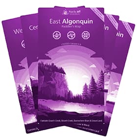 Maps By Jeff - Algonquin Maps
$18.56US
Maps By Jeff - Algonquin Maps
$18.56US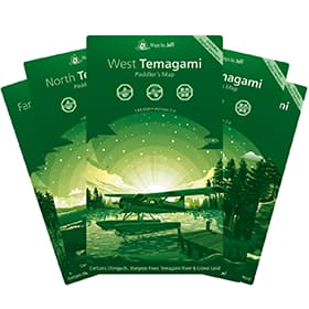 Maps By Jeff - Temagami Paddling Map
$22.09US
Maps By Jeff - Temagami Paddling Map
$22.09US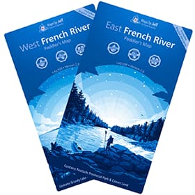 Maps By Jeff - French River Maps
$18.56US
Maps By Jeff - French River Maps
$18.56US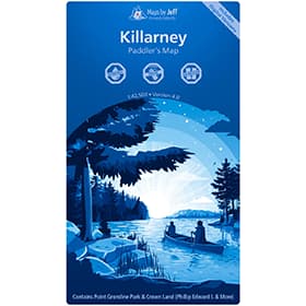 Maps By Jeff - Killarney Paddling Map
$18.56US
Maps By Jeff - Killarney Paddling Map
$18.56US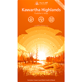 Maps By Jeff - Kawartha Highlands Paddling Map
$18.56US
Maps By Jeff - Kawartha Highlands Paddling Map
$18.56US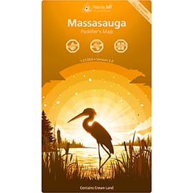 Maps By Jeff - Massasauga Paddling Map
$18.56USSold Out
Maps By Jeff - Massasauga Paddling Map
$18.56USSold Out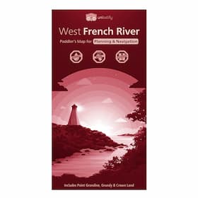 Unlostify West French River Camping Map
About Maps By Jeff
Jeff McMurtry has changed the face of canoeing and hiking maps for Algonquin, Killarney and the Temagami region. Waterproof, and made to be used on the field, Maps By Jeff don’t just show routes, elevations, and portages. These elegantly designed and relentlessly detailed maps show routes, topography, accurate portage lengths, historical and other sites of interest, flora, fauna, original First Nation location names, crown land and much, much more. Jeff’s passion and unabating drive for accuracy and detail make Maps By Jeff's maps a pleasure to read and use when planning, or undertaking a hiking, camping or canoe trip.
Our Maps By Jeff
We stock only the best in Maps By Jeff so you can rest assured knowing you're COEC Equipped.
Maps By Jeff - Algonquin MapsMaps By Jeff's Algonquin Maps are new waterproof maps of Algonquin park and the surrounding area that are highly detailed, functionally beautiful, and relentlessly accurate.
Maps By Jeff - Temagami Paddling MapsMaps By Jeff's Temagami paddling maps, are five, new waterproof maps of the Temagami region and surrounding area that are highly detailed, functionally beautiful, and relentlessly accurate.
Maps By Jeff - French RiverMaps By Jeff's French River Provincial Park and area maps are waterproof and tear resistant maps of the French River and the surrounding area that are highly detailed, functionally beautiful, and relentlessly accurate.
Maps By Jeff - KillarneyThe Maps By Jeff - Killarney Paddling Map provides the means for planning and executing a trip in Killarney Provincial Park, including access points, supply locations, canoe routes, portages and hiking routes (complete with times, length and difficulty guides), points of interest, local history and more. Waterproof and tear-resistant, the Maps By Jeff - Killarney Paddling Map is a must have for your Killarney trips.
Maps By Jeff - Kawartha Highlands Paddling MapEver seen the largest collection of ancient petroglyphs in Canada? Or a very rare “meromictic” lake? With the newly updated, Maps By Jeff - Kawartha Highlands Paddling Map get ready to see more of the Kawartha Highlands Provincial Park than ever before - including Petroglyphs Provincial Park, and surrounding Crown lands. Maps By Jeff maps are tear proof, water proof, and even float.
Maps By Jeff - Massasauga Paddling MapEver seen a perfectly round glacial pothole? Or a perfectly restored 1940’s lakeside cabin (now a museum)? Well, with the newly updated Maps By Jeff - Massasauga Paddling Map, get ready to see more of Massasauga Provincial Park than ever before. Includes Georgian Bay and all local Crown Lands. At a scale of 1:23,000, its water proof, tear proof, and only 46 grams. It even floats.
Sold Out Unlostify West French River Camping MapEver seen the French River ghost town? Or the longest snowmobile bridge in the world? With the Unlostify West French River Camping Map, get ready to see more of the French River than ever before - including the west French River, Pointe Grondine, Grundy, and surrounding Crown Lands. Water proof, tear proof, and only 46 grams - it even floats.